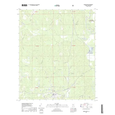
2018 Map of Marion North
USGS Topo · Published 2018About this map
Judson College anchors the historic southern edge of this landscape, marking the northern reach of Marion as it transitions into the rural Alabama hills. The terrain is defined by the winding course of the Cahaba River to the east and a network of creeks, including Old Town Creek and Rice Cr, that carve through the landscape. This area maintains a strong connection to its 19th-century roots, evidenced by the numerous small family and community burial grounds like Heard Cem, Mount Nebo Cem, and Scarborough Cem scattered among the timberlands.
Find a feature on this map
66 named features on this map. Tap any name to fly to it.
Don’t see what you’re looking for? This feature index may not catch every label — zoom into the map to look around manually.
Map Details
Editions of this 2018 Marion North Map
This is the sole edition of this map. No revisions or reprints were ever made.
Other maps of this area

1953 · Montgomery
USGS Topo · 1:250,000

1956 · Montgomery
USGS Topo · 1:250,000

1957 · Montgomery
USGS Topo · 1:250,000

1959 · Summerfield
USGS Topo · 1:62,500

1975 · Summerfield SW
USGS Topo · 1:24,000

1979 · Marion North
USGS Topo · 1:24,000

1979 · Scott Station
USGS Topo · 1:24,000

1979 · Morgan Springs
USGS Topo · 1:24,000

1979 · Marion South
USGS Topo · 1:24,000

1979 · Harrisburg
USGS Topo · 1:24,000