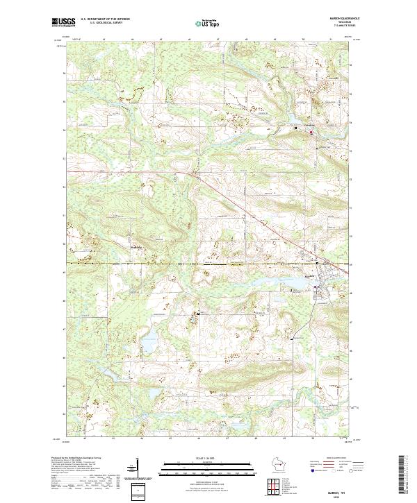
2022 Map of Marion
USGS Topo · Published 2022About this map
The Shawano and Waupaca County line bisects this region of Wisconsin, where the communities of Marion, Caroline, and Hunting are situated among a complex network of waterways. The river systems here are the primary geographical drivers, with the South Branch Embarrass River and the Middle Branch Embarrass River converging near Caroline. To the south, the North Branch Pigeon River flows into Marion Pond, anchoring the layout of the city of Marion.
Find a feature on this map
56 named features on this map. Tap any name to fly to it.
Don’t see what you’re looking for? This feature index may not catch every label — zoom into the map to look around manually.
Map Details
Editions of this 2022 Marion Map
This is the sole edition of this map. No revisions or reprints were ever made.
Other maps of this area

1954 · Wittenberg
USGS Topo · 1:48,000

1954 · Gresham
USGS Topo · 1:48,000

1955 · Clintonville
USGS Topo · 1:48,000

1955 · Tigerton
USGS Topo · 1:48,000

1955 · Green Bay
USGS Topo · 1:250,000

1964 · Wittenberg
USGS Topo · 1:62,500

1964 · Gresham
USGS Topo · 1:62,500

1970 · Clintonville North
USGS Topo · 1:24,000
1970 · Symco
USGS Topo · 1:24,000
1970 · Marion
USGS Topo · 1:24,000