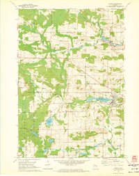
1970 Map of Marion
USGS Topo · Published 1973About this map
Marion sits at the junction of the Chicago and North Western railroad and the Pigeon River, serving as a central hub for this portion of Shawano and Waupaca counties. The landscape is defined by the winding paths of the Middle Branch Embarrass River and South Branch Embarrass River, which supported early settlements like Caroline. This 1970 field-checked survey illustrates a region shaped by both water and rail, with numerous small lakes such as Kinney Lake, Keller Lake, and Long Lake dotting the glacial terrain.
Find a feature on this map
56 named features on this map. Tap any name to fly to it.
Don’t see what you’re looking for? This feature index may not catch every label — zoom into the map to look around manually.
Map Details
Editions of this 1970 Marion Map
2 editions found
Other maps of this area

1954 · Wittenberg
USGS Topo · 1:48,000

1954 · Gresham
USGS Topo · 1:48,000

1955 · Clintonville
USGS Topo · 1:48,000

1955 · Tigerton
USGS Topo · 1:48,000

1955 · Green Bay
USGS Topo · 1:250,000

1964 · Wittenberg
USGS Topo · 1:62,500

1964 · Gresham
USGS Topo · 1:62,500

1970 · Clintonville North
USGS Topo · 1:24,000
1970 · Symco
USGS Topo · 1:24,000
1970 · Big Falls
USGS Topo · 1:24,000