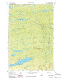
1960 Map of Mark Lake
USGS Topo · Published 1986About this map
The Pat Bayle State Forest and Superior National Forest dominate this Cook County landscape, showing a region defined by its complex hydrology and early timber extraction routes. An extensive Old Railroad Grade winds through the central terrain, marking the path of former logging operations that once moved timber toward the shore. This industrial history is layered with recreational and conservation use, seen in the northern reach of the Boundary Waters Canoe Area Wilderness and the North Shore State Trail. Large water bodies like Pike Lake and Mark Lake are connected by a dense network of smaller drainages, including Mark Creek and Bally Creek, which flow toward the prominent Cascade River. The placement of the Cascade River Campground and various Gravel Pit locations suggest the dual nature of the area as both a protected wilderness and a managed forest during the mid-to-late 20th century.
Find a feature on this map
27 named features on this map. Tap any name to fly to it.
Don’t see what you’re looking for? This feature index may not catch every label — zoom into the map to look around manually.
Map Details
Editions of this 1960 Mark Lake Map
3 editions found

Other maps of this area

1919 · Brule Lake
USGS Topo · 1:62,500

1919 · Grand Marais
USGS Topo · 1:62,500

1919 · Lutsen
USGS Topo · 1:62,500

1954 · Two Harbors
USGS Topo · 1:250,000

1957 · Two Harbors
USGS Topo · 1:250,000

1958 · Two Harbors
USGS Topo · 1:250,000

1958 · Deer Yard Lake
USGS Topo · 1:24,000

1958 · Good Harbor Bay
USGS Topo · 1:24,000

1959 · Lutsen
USGS Topo · 1:24,000

1959 · Lima Mountain
USGS Topo · 1:24,000