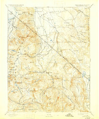
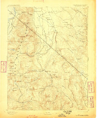
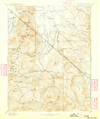
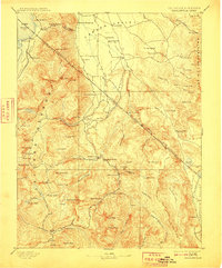
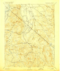
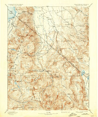
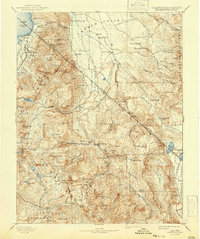
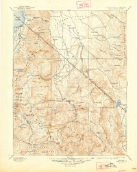
1893 Map of Markleeville
USGS Topo · Published 1930About this map
Markleeville serves as a central hub in this high-altitude landscape, situated where the West Fork Carson River and East Fork Carson River descend from the Sierra Nevada into the Carson Valley. This late nineteenth-century survey, based on 1889 fieldwork, captures the region's early transition from a rugged mining and ranching frontier to a nascent recreational area. To the north, early lakeshore settlements like Bijou and Rowlands sit along the edge of Lake Tahoe, while traveler rest stops such as Twelve Mile House and Desert Station mark the overland routes through the high desert flats.
Find a feature on this map
117 named features on this map. Tap any name to fly to it.
Don’t see what you’re looking for? This feature index may not catch every label — zoom into the map to look around manually.
Map Details
Editions of this 1893 Markleeville Map
9 editions found

Other maps of this area

1889 · Pyramid Peak
USGS Topo · 1:125,000

1889 · Markleeville
USGS Topo · 1:125,000

1891 · Carson
USGS Topo · 1:125,000

1891 · Markleeville
USGS Topo · 1:125,000

1891 · Truckee
USGS Topo · 1:125,000

1891 · Big Trees
USGS Topo · 1:125,000

1891 · Wabuska
USGS Topo · 1:125,000

1891 · Pyramid Peak
USGS Topo · 1:125,000

1891 · Wellington
USGS Topo · 1:125,000

1893 · Carson
USGS Topo · 1:125,000