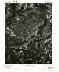
1977 Map of Markleton
USGS Topo · Published 1979About this map
Casselman River winds through the northwestern corner of this 1977 orthophotograph, providing a high-contrast look at the Somerset County landscape during the late seventies. This specialized imagery, produced in cooperation with the Soil Conservation Service, reveals the intricate patterns of forest cover and agricultural clearing. The terrain is defined by several significant water bodies, including the central Deer Valley Lake and the smaller Roberts Lake to its north. Toward the southern edge, the headwaters of the Savage River appear, marking a divide in the local drainage. Unlike standard topographic maps, this aerial perspective captures the exact texture of the woodland and the precise footprints of rural structures and field boundaries as they existed during the spring of 1977, offering researchers a literal view of the land before modern development.
Find a feature on this map
5 named features on this map. Tap any name to fly to it.
Don’t see what you’re looking for? This feature index may not catch every label — zoom into the map to look around manually.
Map Details
Editions of this 1977 Markleton Map
This is the sole edition of this map. No revisions or reprints were ever made.
Other maps of this area

1899 · Grantsville
USGS Topo · 1:62,500

1900 · Accident
USGS Topo · 1:62,500

1904 · Grantsville
USGS Topo · 1:62,500

1921 · Meyersdale
USGS Topo · 1:62,500

1922 · Confluence
USGS Topo · 1:62,500

1931 · Confluence
USGS Topo · 1:62,500

1933 · Confluence
USGS Topo · 1:62,500

1939 · Meyersdale
USGS Topo · 1:62,500

1944 · Meyersdale
USGS Topo · 1:62,500

1946 · Grantsville
USGS Topo · 1:24,000
Featured Places
- Black Township, PA
- Addison Township, PA
- Upper Turkeyfoot Township, PA
- Elk Lick Township, PA
- Markleton, Black Township