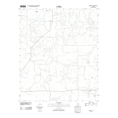
2010 Map of Markley
USGS Topo · Published 2010About this map
Markley and Jermyn anchor this section of Young County, where the landscape is defined by the headwaters of numerous creeks and the industrial presence of the Wilton Oil Field. The terrain is punctuated by distinctive rises including Rattlesnake Mountain, Bare Mountain, and Spie Knob, providing landmarks for a network of ranch and farm roads such as Markley Rd and Stewart Ranch Rd. The drainage patterns of Cameron Creek, Plum Creek, and Stewart Creek illustrate the natural topography of the region. Near the southern boundary, Jermyn sits along the road to Graceland Cemetery, reflecting the long-established communities of the area. This survey documents the intersection of rural ranching life and the energy industry at the beginning of the 21st century.
Find a feature on this map
30 named features on this map. Tap any name to fly to it.
Don’t see what you’re looking for? This feature index may not catch every label — zoom into the map to look around manually.
Map Details
Editions of this 2010 Markley Map
This is the sole edition of this map. No revisions or reprints were ever made.
Other maps of this area

1927 · Graham
USGS Topo · 1:62,500

1954 · Wichita Falls
USGS Topo · 1:250,000

1958 · Wichita Falls
USGS Topo · 1:250,000

1962 · Antelope Creek NE
USGS Topo · 1:24,000

1964 · Senate
USGS Topo · 1:24,000

1964 · Darnell Branch
USGS Topo · 1:24,000

1964 · Loving
USGS Topo · 1:24,000

1964 · Bryson
USGS Topo · 1:24,000

1964 · Lake Eddleman
USGS Topo · 1:24,000

1964 · Lynn Creek
USGS Topo · 1:24,000