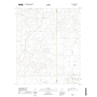
2019 Map of Markley
USGS Topo · Published 2019About this map
Markley and Jermyn anchor this landscape along the border of Young and Jack Counties, illustrating the rural ranching and residential patterns of north-central Texas. The topography is defined by prominent elevations such as Bare Mtn, Rattlesnake Mtn, and Spie Knob, which overlook a network of seasonal watercourses including Plum Cr, Brushy Cr, and Cameron Cr. Local history is visible in the network of family-named roads like Stewart Ranch Rd, Caldwell Rd, and Roney Rd, alongside the Graceland Cem situated near the southern edge. The map reveals the layout of the Jermyn townsite, with its distinct residential grid featuring Baptist Ave and streets named for neighboring counties. This 2019 survey documents a landscape where modern transportation routes like FM 1769 and FM 1191 intersect with much older ranching paths and property boundaries.
Find a feature on this map
38 named features on this map. Tap any name to fly to it.
Don’t see what you’re looking for? This feature index may not catch every label — zoom into the map to look around manually.
Map Details
Editions of this 2019 Markley Map
This is the sole edition of this map. No revisions or reprints were ever made.
Other maps of this area

1927 · Graham
USGS Topo · 1:62,500

1954 · Wichita Falls
USGS Topo · 1:250,000

1958 · Wichita Falls
USGS Topo · 1:250,000

1962 · Antelope Creek NE
USGS Topo · 1:24,000

1964 · Senate
USGS Topo · 1:24,000

1964 · Darnell Branch
USGS Topo · 1:24,000

1964 · Loving
USGS Topo · 1:24,000

1964 · Bryson
USGS Topo · 1:24,000

1964 · Lake Eddleman
USGS Topo · 1:24,000

1964 · Lynn Creek
USGS Topo · 1:24,000