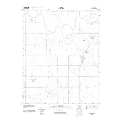
2009 Map of Marland
USGS Topo · Published 2009About this map
The Salt Fork Arkansas River winds across the northern landscape of Noble County, defining a region where energy extraction and water management intersect. This 2009 survey shows the town of Marland at the heart of the quadrangle, surrounded by the industrial footprints of the Three Sands Oil Field and the Ceres South Oil Field. The terrain is marked by numerous water control projects, including the Oknoname 103011 Reservoir and Longbranch Site 2 Reservoir, each supported by their respective dams. For local historians, the Cowboy Hill Cemetery near the river bend and topographic landmarks like Spindle Top Hill offer specific points of interest. The area's hydrology is further shaped by Birds Nest Creek and Deadman Creek, which feed into the larger river system and man-made reservoirs, illustrating the rural infrastructure of early 21st-century Oklahoma.
Find a feature on this map
28 named features on this map. Tap any name to fly to it.
Don’t see what you’re looking for? This feature index may not catch every label — zoom into the map to look around manually.
Map Details
Editions of this 2009 Marland Map
This is the sole edition of this map. No revisions or reprints were ever made.
Other maps of this area

1955 · Enid
USGS Topo · 1:250,000

1958 · Enid
USGS Topo · 1:250,000

1968 · Tonkawa SE
USGS Topo · 1:24,000

1968 · Marland
USGS Topo · 1:24,000

1968 · Ponca City NW
USGS Topo · 1:24,000

1968 · Ponca City SE
USGS Topo · 1:24,000

1968 · Tonkawa
USGS Topo · 1:24,000
1968 · Ponca City
USGS Topo · 1:24,000

1972 · Morrison NE
USGS Topo · 1:24,000

1972 · Red Rock
USGS Topo · 1:24,000