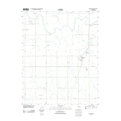
2013 Map of Marland
USGS Topo · Published 2013About this map
Marland and the nearby site of Old Bliss anchor this North Central Oklahoma landscape where the agricultural grid meets legacy energy production. The Salt Fork Arkansas River meanders across the northern section of the map, creating unique hydrological features like the oxbow at Horseshoe Lake. The area's industrial history is well-marked by the Three Sands Oil Field in the northwest and the Ceres South Oil Field further south, illustrating the enduring footprint of petroleum extraction in Noble County.
Find a feature on this map
44 named features on this map. Tap any name to fly to it.
Don’t see what you’re looking for? This feature index may not catch every label — zoom into the map to look around manually.
Map Details
Editions of this 2013 Marland Map
This is the sole edition of this map. No revisions or reprints were ever made.
Other maps of this area

1955 · Enid
USGS Topo · 1:250,000

1958 · Enid
USGS Topo · 1:250,000

1968 · Tonkawa SE
USGS Topo · 1:24,000

1968 · Marland
USGS Topo · 1:24,000

1968 · Ponca City NW
USGS Topo · 1:24,000

1968 · Ponca City SE
USGS Topo · 1:24,000

1968 · Tonkawa
USGS Topo · 1:24,000
1968 · Ponca City
USGS Topo · 1:24,000

1972 · Morrison NE
USGS Topo · 1:24,000

1972 · Red Rock
USGS Topo · 1:24,000