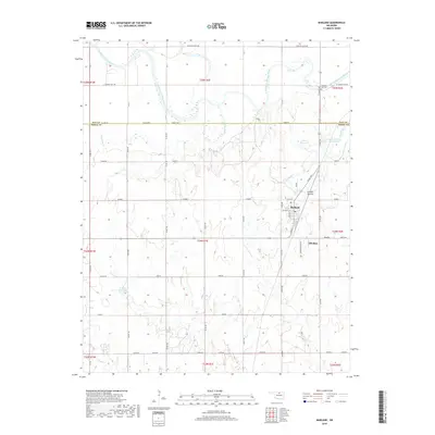
2018 Map of Marland
USGS Topo · Published 2018About this map
The Salt Fork Arkansas River carves a winding path across this landscape on the border of Kay and Noble Counties. This area is anchored by the community of Marland, which is situated along the BNSF Railway. Just to the southeast lies Old Bliss, a name reflecting the local history of settlement and rail relocation in north-central Oklahoma. The terrain is defined by natural landmarks such as Spindle Top Hill and the Badlands, with numerous smaller waterways like Birds Nest Cr and Deadman Cr draining the prairie.
Find a feature on this map
40 named features on this map. Tap any name to fly to it.
Don’t see what you’re looking for? This feature index may not catch every label — zoom into the map to look around manually.
Map Details
Editions of this 2018 Marland Map
This is the sole edition of this map. No revisions or reprints were ever made.
Other maps of this area

1955 · Enid
USGS Topo · 1:250,000

1958 · Enid
USGS Topo · 1:250,000

1968 · Tonkawa SE
USGS Topo · 1:24,000

1968 · Marland
USGS Topo · 1:24,000

1968 · Ponca City NW
USGS Topo · 1:24,000

1968 · Ponca City SE
USGS Topo · 1:24,000

1968 · Tonkawa
USGS Topo · 1:24,000
1968 · Ponca City
USGS Topo · 1:24,000

1972 · Morrison NE
USGS Topo · 1:24,000

1972 · Red Rock
USGS Topo · 1:24,000