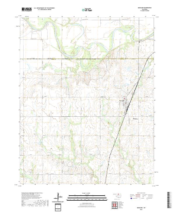
2022 Map of Marland
USGS Topo · Published 2022About this map
Marland sits at the intersection of a grid-work road system that bridges the boundary of Kay and Noble counties. The town is situated just south of the meandering Salt Fork Arkansas River, which dominates the northern reaches of the quadrangle. A unique local identifier, Old Bliss, is noted just south of the primary settlement, suggesting the shifting location or evolution of this rural community over time. The landscape is marked by subtle but distinct topography, including the Spindle Top Hill and a designated area of Badlands to the east. Water management is a visible priority across these sections, evidenced by several numbered reservoirs such as 103011 Reservoir and named basins like Longbranch Site 2 Reservoir. Several small drainages, including Deadman Cr and Birds Nest Cr, carve through the rolling terrain, providing natural breaks in the agricultural grid.
Find a feature on this map
37 named features on this map. Tap any name to fly to it.
Don’t see what you’re looking for? This feature index may not catch every label — zoom into the map to look around manually.
Map Details
Editions of this 2022 Marland Map
This is the sole edition of this map. No revisions or reprints were ever made.
Other maps of this area

1955 · Enid
USGS Topo · 1:250,000

1958 · Enid
USGS Topo · 1:250,000

1968 · Tonkawa SE
USGS Topo · 1:24,000

1968 · Marland
USGS Topo · 1:24,000

1968 · Ponca City NW
USGS Topo · 1:24,000

1968 · Ponca City SE
USGS Topo · 1:24,000

1968 · Tonkawa
USGS Topo · 1:24,000
1968 · Ponca City
USGS Topo · 1:24,000

1972 · Morrison NE
USGS Topo · 1:24,000

1972 · Red Rock
USGS Topo · 1:24,000