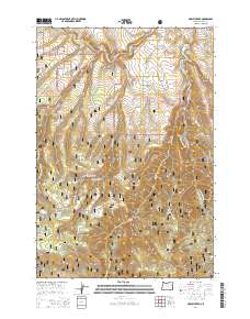
2014 Map of Marley Creek
USGS Topo · Published 2014About this map
Starkey and the nearby Camp Elkanah serve as central nodes in this pocket of the Whitman National Forest, where the landscape is defined by the winding course of the Grande Ronde River. The area's settlement history is quietly anchored by the Starkey Cem along McIntyre Rd, providing a specific point of interest for genealogists tracing families from this upland terrain. The map details a complex network of forest development roads, such as Nat For Dev Rd 2444 and Fly Creek Rd, which navigate around prominent elevations like Fly Ridge and Whitehorse Ridge.
Find a feature on this map
38 named features on this map. Tap any name to fly to it.
Don’t see what you’re looking for? This feature index may not catch every label — zoom into the map to look around manually.
Map Details
Editions of this 2014 Marley Creek Map
This is the sole edition of this map. No revisions or reprints were ever made.
Other maps of this area

1953 · Pendleton
USGS Topo · 1:250,000

1956 · Pendleton
USGS Topo · 1:250,000

1964 · Mc Intyre Creek
USGS Topo · 1:24,000

1964 · Kamela SE
USGS Topo · 1:24,000

1965 · Limber Jim Creek
USGS Topo · 1:24,000

1965 · Marley Creek
USGS Topo · 1:24,000

1965 · Little Beaver Creek
USGS Topo · 1:24,000

1965 · Fly Valley
USGS Topo · 1:24,000

1967 · Tower Mtn
USGS Topo · 1:24,000

1967 · Sullivan Gulch
USGS Topo · 1:24,000