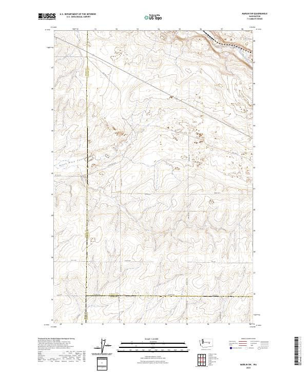
2023 Map of Marlin SW
USGS Topo · Published 2023About this map
Black Rock Coulee cuts a distinct path through this section of the Channeled Scablands, where the borders of Grant, Lincoln, and Adams counties converge. The landscape is defined by the sharp basalt coulees and dry washes typical of this corner of Washington, with Crab Creek appearing in the northern portion of the survey. The mapping reveals a sparse but rigid network of section-line roads and family-named routes, such as Black Rock Rd and Kissler Rd, which navigate the elevation changes between the high plateaus and the coulee floor. This modern record captures the enduring agricultural and ranching layout of the region, where the vastness of the terrain is marked by remote bypasses like Old Hwy Lp and the intersection of Bates Rd E and Graedel Rd.
Find a feature on this map
27 named features on this map. Tap any name to fly to it.
Don’t see what you’re looking for? This feature index may not catch every label — zoom into the map to look around manually.
Map Details
Editions of this 2023 Marlin SW Map
This is the sole edition of this map. No revisions or reprints were ever made.
Other maps of this area

1923 · Wheeler
USGS Topo · 1:62,500

1925 · Wheeler
USGS Topo · 1:62,500

1925 · Schrag
USGS Topo · 1:62,500

1953 · Ritzville
USGS Topo · 1:250,000

1956 · Wheeler NE
USGS Topo · 1:24,000

1956 · Wilson Creek SE
USGS Topo · 1:24,000

1956 · Wilson Creek
USGS Topo · 1:62,500
1956 · Wheeler
USGS Topo · 1:62,500

1959 · Ritzville
USGS Topo · 1:250,000

1965 · Ritzville
USGS Topo · 1:250,000