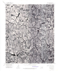
1975 Map of Marlow NE
USGS Topo · Published 1976About this map
Bailey and the northern extent of Bray anchor this 1975 aerial perspective of Grady County, where the agricultural landscape is defined by an intricate network of dendritic drainage patterns. The orthophoto reveals a patchwork of tilled fields, pastureland, and wooded creek bottoms that illustrate mid-century land use in central Oklahoma. Unlike traditional topographic maps, this survey provides a direct visual record of farmstead placement, livestock ponds, and the precise grain of the terrain as it existed during the mid-1970s. The dense concentration of small water impoundments across the northern reaches reflects the region's reliance on localized water management for ranching and farming operations.
Find a feature on this map
2 named features on this map. Tap any name to fly to it.
Don’t see what you’re looking for? This feature index may not catch every label — zoom into the map to look around manually.
Map Details
Editions of this 1975 Marlow NE Map
This is the sole edition of this map. No revisions or reprints were ever made.
Other maps of this area

1902 · Rush Springs
USGS Topo · 1:125,000

1949 · Rush Springs
USGS Topo · 1:62,500

1950 · Rush Springs
USGS Topo · 1:62,500

1950 · Marlow
USGS Topo · 1:62,500

1951 · Marlow
USGS Topo · 1:62,500

1957 · Ardmore
USGS Topo · 1:250,000

1963 · Ardmore
USGS Topo · 1:250,000

1966 · Lindsay SW
USGS Topo · 1:24,000
1974 · Cox City
USGS Topo · 1:24,000
1974 · Lake Fuqua
USGS Topo · 1:24,000