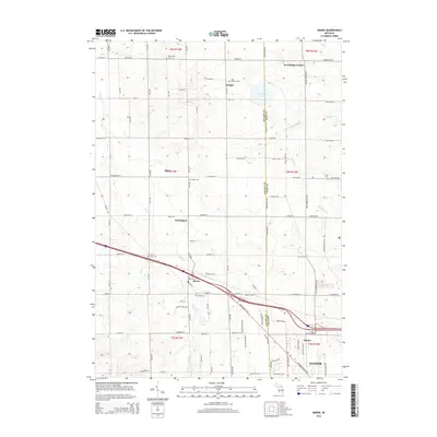
2014 Map of Marne
USGS Topo · Published 2014About this map
Marne and the nearby community of Kinney anchor this survey of the terrain where Ottawa and Kent counties meet. The landscape is defined by a dense grid of rural roads and a series of historical burial grounds, including Saint Mary's Cem and Marne Cem, which reflect the long-standing settlement of this agricultural region. The drainage patterns of Sand Cr and Indian Mill Cr underscore the area's hydrology, feeding into local landmarks like Cranberry Lake. Small clusters of development at Fruit Ridge Center, Herrington, and Wright show the persistent rural character of the township even as modern transport routes have evolved. Genealogists will find the distribution of cemeteries like Wells Cem and Cross Cem particularly useful for locating early family centers within the township divisions of t8n r13w and t7n r12w.
Find a feature on this map
99 named features on this map. Tap any name to fly to it.
Don’t see what you’re looking for? This feature index may not catch every label — zoom into the map to look around manually.
Map Details
Editions of this 2014 Marne Map
This is the sole edition of this map. No revisions or reprints were ever made.
Other maps of this area

1914 · Grand Rapids
USGS Topo · 1:62,500

1918 · Cedar Springs
USGS Topo · 1:62,500

1943 · Cedar Springs
USGS Topo · 1:62,500

1943 · Grand Rapids
USGS Topo · 1:62,500

1945 · Ravenna
USGS Topo · 1:62,500

1954 · Midland
USGS Topo · 1:250,000

1958 · Midland
USGS Topo · 1:250,000

1958 · Allendale
USGS Topo · 1:24,000

1958 · Grandville
USGS Topo · 1:62,500

1958 · Grandville
USGS Topo · 1:24,000