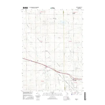
2017 Map of Marne
USGS Topo · Published 2017About this map
Marne and the surrounding farmland of Ottawa and Kent Counties are defined by a mix of traditional agricultural tracts and modern recreational corridors. This 2017 survey shows the Musketawa State Trail and the Fred Meijer Pioneer State Trail intersecting the landscape, following former rail grades that once drove the local economy. The area is dotted with historical anchors, including numerous small cemeteries such as Wells Cem, Cross Cem, and Big Springs Cem, which provide significant touchstones for genealogical research in this part of Michigan. The terrain is drained by systems like Sand Creek and the Wright and Alpine Drain, flowing through a grid of established section roads. Smaller settlements like Reno, Herrington, and Fruit Ridge Center persist as local landmarks, while the eastern edge of the map shows the residential expansion of Walker near Kinney.
Find a feature on this map
68 named features on this map. Tap any name to fly to it.
Don’t see what you’re looking for? This feature index may not catch every label — zoom into the map to look around manually.
Map Details
Editions of this 2017 Marne Map
This is the sole edition of this map. No revisions or reprints were ever made.
Other maps of this area

1914 · Grand Rapids
USGS Topo · 1:62,500

1918 · Cedar Springs
USGS Topo · 1:62,500

1943 · Cedar Springs
USGS Topo · 1:62,500

1943 · Grand Rapids
USGS Topo · 1:62,500

1945 · Ravenna
USGS Topo · 1:62,500

1954 · Midland
USGS Topo · 1:250,000

1958 · Midland
USGS Topo · 1:250,000

1958 · Allendale
USGS Topo · 1:24,000

1958 · Grandville
USGS Topo · 1:62,500

1958 · Grandville
USGS Topo · 1:24,000