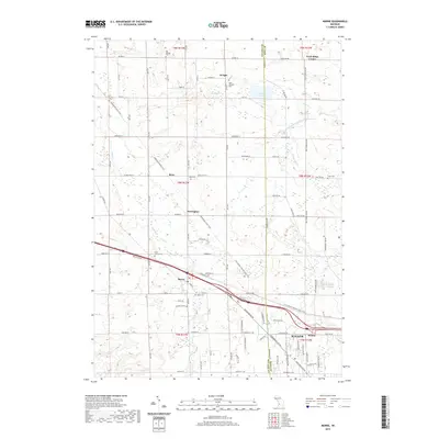
2019 Map of Marne
USGS Topo · Published 2019About this map
The boundary between Ottawa Co and Kent Co bisects this landscape of orchards and small crossroads settlements during the late 2010s. The village of Marne serves as a central hub, situated along the corridor of the Fred Meijer Pioneer State Trail. To the east, the edge of Walker and the community of Kinney indicate the approach of the Grand Rapids metropolitan area. The northern reaches are characterized by agricultural centers like Fruit Ridge Center and Wright, where local history is anchored by several long-established burial grounds including Saint Joseph's Cem and Big Springs Cem.
Find a feature on this map
64 named features on this map. Tap any name to fly to it.
Don’t see what you’re looking for? This feature index may not catch every label — zoom into the map to look around manually.
Map Details
Editions of this 2019 Marne Map
This is the sole edition of this map. No revisions or reprints were ever made.
Other maps of this area

1914 · Grand Rapids
USGS Topo · 1:62,500

1918 · Cedar Springs
USGS Topo · 1:62,500

1943 · Cedar Springs
USGS Topo · 1:62,500

1943 · Grand Rapids
USGS Topo · 1:62,500

1945 · Ravenna
USGS Topo · 1:62,500

1954 · Midland
USGS Topo · 1:250,000

1958 · Midland
USGS Topo · 1:250,000

1958 · Allendale
USGS Topo · 1:24,000

1958 · Grandville
USGS Topo · 1:62,500

1958 · Grandville
USGS Topo · 1:24,000