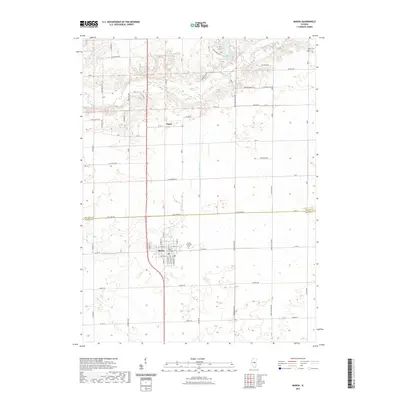
2021 Map of Maroa
USGS Topo · Published 2021About this map
Maroa anchors the southern portion of this central Illinois landscape, where the agricultural grid is interrupted by the meandering courses of Salt Creek and the N Fork Lake Fork. The town's layout, centered around streets like W Jackson St and E Jackson St, reflects a classic Midwestern rail-town geometry, even as the surrounding township remains dedicated to large-scale farming. To the north, the small settlement of Ospur sits near the winding Salt Creek, which flows past landmarks like Iron Bridge Rd and the waters of Banta Lakes. Local heritage is preserved at the Maroa Township Cem and the more remote Rose Cem in the northeast. The presence of Weldon Springs Lake suggests the region's managed water resources, while a dense network of county roads like Heritage Rd and Duroc Rd provides a detailed look at the rural infrastructure spanning the border of De Witt and Macon counties.
Find a feature on this map
43 named features on this map. Tap any name to fly to it.
Don’t see what you’re looking for? This feature index may not catch every label — zoom into the map to look around manually.
Map Details
Editions of this 2021 Maroa Map
This is the sole edition of this map. No revisions or reprints were ever made.
Other maps of this area

1929 · Decatur
USGS Topo · 1:62,500

1933 · Decatur
USGS Topo · 1:62,500

1954 · Niantic
USGS Topo · 1:62,500

1957 · Kenney
USGS Topo · 1:62,500

1957 · Maroa
USGS Topo · 1:62,500

1958 · Peoria
USGS Topo · 1:250,000

1958 · Decatur
USGS Topo · 1:250,000

1961 · Peoria
USGS Topo · 1:250,000

1961 · Decatur
USGS Topo · 1:250,000

1963 · Peoria
USGS Topo · 1:250,000