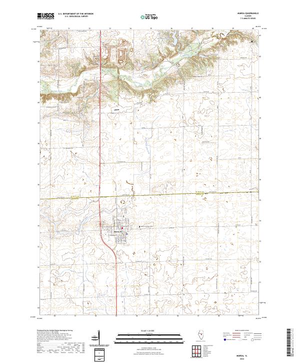
2024 Map of Maroa
USGS Topo · Published 2024About this map
The city of Maroa anchors this survey of central Illinois, situated at the boundary of De Witt and Macon counties. This landscape is defined by its transition from the structured agricultural grid of the prairie to the winding drainage basins of Salt Creek and its tributaries. To the north, the terrain softens around Weldon Springs Lake and the wooded bluffs near Rose Cemetery, offering a distinct contrast to the expansive farmsteads that dominate the southern half of the quadrangle. Local history researchers will find the small settlement of Ospur and the Maroa Township Cemetery as key markers of the area's development. The hydrological network, including the North Fork Lake Fork and Banta Lakes, illustrates how water management and natural drainage have historically shaped the township boundaries and local road placements in this part of the Illinois Corn Belt.
Find a feature on this map
68 named features on this map. Tap any name to fly to it.
Don’t see what you’re looking for? This feature index may not catch every label — zoom into the map to look around manually.
Map Details
Editions of this 2024 Maroa Map
This is the sole edition of this map. No revisions or reprints were ever made.
Other maps of this area

1929 · Decatur
USGS Topo · 1:62,500

1933 · Decatur
USGS Topo · 1:62,500

1954 · Niantic
USGS Topo · 1:62,500

1957 · Kenney
USGS Topo · 1:62,500

1957 · Maroa
USGS Topo · 1:62,500

1958 · Peoria
USGS Topo · 1:250,000

1958 · Decatur
USGS Topo · 1:250,000

1961 · Peoria
USGS Topo · 1:250,000

1961 · Decatur
USGS Topo · 1:250,000

1963 · Peoria
USGS Topo · 1:250,000