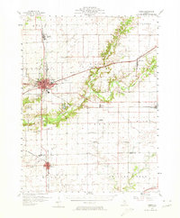
1957 Map of Maroa
USGS Topo · Published 1974About this map
The rail-driven growth of Central Illinois is evident in this mid-century survey, centered on the hub of Clinton. The town's urban footprint is detailed with its education and industrial infrastructure, including the Washington Sch and a Sewage Disposal Sanitary Fill. To the south, Maroa anchors the southern boundary at the crossing of the Pennsylvania and Illinois Central lines. The surrounding landscape is a grid of agricultural productivity, yet it preserves a deeper social geography through its many family-named landmarks and rural institutions.
Find a feature on this map
56 named features on this map. Tap any name to fly to it.
Don’t see what you’re looking for? This feature index may not catch every label — zoom into the map to look around manually.
Map Details
Editions of this 1957 Maroa Map
2 editions found

Other maps of this area

1929 · Decatur
USGS Topo · 1:62,500

1933 · Decatur
USGS Topo · 1:62,500

1937 · Monticello
USGS Topo · 1:48,000

1943 · Monticello
USGS Topo · 1:62,500

1949 · Mc Lean
USGS Topo · 1:62,500

1951 · McLean
USGS Topo · 1:62,500

1951 · Le Roy
USGS Topo · 1:62,500

1952 · Arrowsmith
USGS Topo · 1:62,500

1954 · Niantic
USGS Topo · 1:62,500

1955 · Bement
USGS Topo · 1:62,500