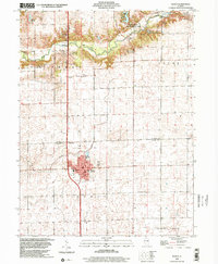
1998 Map of Maroa
USGS Topo · Published 2001About this map
The town of Maroa anchors the southern half of this landscape at the boundary of De Witt and Macon Counties. Located along the Illinois Central Railroad, the settlement shows a mid-century development pattern including the Maroa-Forsyth High Sch, Maroa Cem, and a local Sewage Disposal plant. This region is defined by the transition from the grid-iron agricultural fields of Maroa and Texas townships to the more varied topography of the north.
Find a feature on this map
23 named features on this map. Tap any name to fly to it.
Don’t see what you’re looking for? This feature index may not catch every label — zoom into the map to look around manually.
Map Details
Editions of this 1998 Maroa Map
This is the sole edition of this map. No revisions or reprints were ever made.
Other maps of this area

1929 · Decatur
USGS Topo · 1:62,500

1933 · Decatur
USGS Topo · 1:62,500

1954 · Niantic
USGS Topo · 1:62,500

1957 · Kenney
USGS Topo · 1:62,500

1957 · Maroa
USGS Topo · 1:62,500

1958 · Peoria
USGS Topo · 1:250,000

1958 · Decatur
USGS Topo · 1:250,000

1961 · Peoria
USGS Topo · 1:250,000

1961 · Decatur
USGS Topo · 1:250,000

1963 · Peoria
USGS Topo · 1:250,000