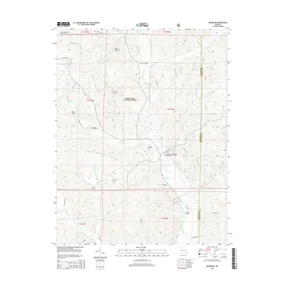
2015 Map of Marquand
USGS Topo · Published 2015About this map
The Upper Castor River snakes through the heart of the Saint Francois Mountains in this Madison County landscape, where the town of Marquand sits at the junction of valley roads and hollows. The terrain is defined by its deep drainages and named gaps, such as Dog Trot Hollow and Vernum Hollow, which break up the high ground of Cottoner Mtn. Much of the western portion of the area is protected within the Mark Twain National Forest, illustrating the region's transition from early timbering and settlement to modern conservation. Genealogists will find a concentrated cluster of family burial sites in the river valley, including Mouser Cemetery and Whitener Cemetery. Further west, the settlement of Klendike and landmarks like Stephens Cemetery offer points of interest for those tracing the footprints of rural upland communities that persisted along the spring-fed branches of Greasy Cr and White Spring Br.
Find a feature on this map
44 named features on this map. Tap any name to fly to it.
Don’t see what you’re looking for? This feature index may not catch every label — zoom into the map to look around manually.
Map Details
Editions of this 2015 Marquand Map
This is the sole edition of this map. No revisions or reprints were ever made.
Other maps of this area

1910 · Higdon
USGS Topo · 1:62,500

1930 · Coldwater
USGS Topo · 1:62,500

1933 · Marquand
USGS Topo · 1:62,500

1938 · Marquand
USGS Topo · 1:62,500

1939 · Fredericktown
USGS Topo · 1:48,000

1947 · Fredericktown
USGS Topo · 1:62,500

1949 · Rolla
USGS Topo · 1:250,000

1949 · Coldwater
USGS Topo · 1:62,500

1950 · Fredericktown
USGS Topo · 1:62,500

1953 · Rolla
USGS Topo · 1:250,000