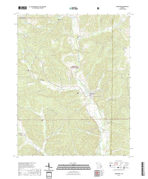
2021 Map of Marquand
USGS Topo · Published 2021About this map
The Upper Castor River flows through the center of this Ozark landscape, marking the transition between the Saint Francois Mountains and the dense woodlands of the Mark Twain National Forest. This 2021 study reveals a region defined by its narrow hollows and numerous family-named cemeteries that speak to the area's deep genealogical roots. The small settlement of Marquand sits at a geographic crossroads near Dog Trot Hollow, while the community of Klendike is situated further west. The map records several notable burial sites including Snowdenville Cem, Rhodes Chapel Cem, and Shetley's Creek Cem. The rugged geography is shaped by watercourses like Greasy Cr and Whitener Cr, which carve through prominent peaks such as Cottoner Mtn. This document serves as a modern record of land use and family history in Madison and Bollinger counties.
Find a feature on this map
53 named features on this map. Tap any name to fly to it.
Don’t see what you’re looking for? This feature index may not catch every label — zoom into the map to look around manually.
Map Details
Editions of this 2021 Marquand Map
This is the sole edition of this map. No revisions or reprints were ever made.
Other maps of this area

1910 · Higdon
USGS Topo · 1:62,500

1930 · Coldwater
USGS Topo · 1:62,500

1933 · Marquand
USGS Topo · 1:62,500

1938 · Marquand
USGS Topo · 1:62,500

1939 · Fredericktown
USGS Topo · 1:48,000

1947 · Fredericktown
USGS Topo · 1:62,500

1949 · Rolla
USGS Topo · 1:250,000

1949 · Coldwater
USGS Topo · 1:62,500

1950 · Fredericktown
USGS Topo · 1:62,500

1953 · Rolla
USGS Topo · 1:250,000