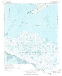
1968 Map of Marsh Island
USGS Topo · Published 1976About this map
Russell Sage Foundation - Marsh Island State Wildlife Refuge dominates this coastal landscape, protecting a complex labyrinth of bayous and brackish lakes along the Louisiana shoreline. The 1968 environment is defined by its industrial and recreational intersections, featuring offshore energy production in the Vermilion Bay Oil and Gas Field and West Cote Blanche Field alongside public spaces like Cypremort Point Beach.
Find a feature on this map
59 named features on this map. Tap any name to fly to it.
Don’t see what you’re looking for? This feature index may not catch every label — zoom into the map to look around manually.
Map Details
Editions of this 1968 Marsh Island Map
2 editions found
Other maps of this area

1932 · Bayou Blanc
USGS Topo · 1:31,680

1932 · Abbeville SE
USGS Topo · 1:31,680

1937 · Bayou Sale
USGS Topo · 1:62,500

1937 · Jeanerette
USGS Topo · 1:62,500

1937 · Derouen
USGS Topo · 1:62,500

1945 · New Orleans
USGS Topo · 1:250,000

1946 · Redfish Point NE
USGS Topo · 1:31,680

1946 · Redfish Point SE
USGS Topo · 1:31,680
1948 · Bayou Blanc
USGS Topo · 1:24,000

1948 · Cypremort Point
USGS Topo · 1:24,000