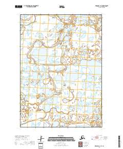
2018 Map of Marshall A-1 SE
USGS Topo · Published 2018About this map
Johnson River and the Pikmiktalik River define this wet, alluvial landscape within the Bethel Census Area. The terrain is a complex network of marshes, ponds, and shifting watercourses, showing the intricate hydrography of the Alaskan wilderness as documented by the U.S. Geological Survey and the National Hydrography Dataset. This map reveals the seasonal nature of the landscape, where the distinction between land and water is often fluid. While the area lacks permanent named settlements or roads, the survey provides precise township and range coordinates, including t12n r73w and t11n r72w, which are essential for navigating or claiming land in this part of the state.
Find a feature on this map
6 named features on this map. Tap any name to fly to it.
Don’t see what you’re looking for? This feature index may not catch every label — zoom into the map to look around manually.
Map Details
Editions of this 2018 Marshall A-1 SE Map
This is the sole edition of this map. No revisions or reprints were ever made.
Other maps of this area

1947 · Russian Mission
USGS Topo · 1:250,000

1950 · Russian Mission
USGS Topo · 1:250,000

1950 · Bethel
USGS Topo · 1:250,000

1951 · Marshall
USGS Topo · 1:250,000

1951 · Baird Inlet
USGS Topo · 1:250,000

1954 · Russian Mission A-8
USGS Topo · 1:63,360

1954 · Marshall A-1
USGS Topo · 1:63,360

1954 · Bethel D-8
USGS Topo · 1:63,360

1954 · Marshall
USGS Topo · 1:250,000

1954 · Baird Inlet
USGS Topo · 1:250,000