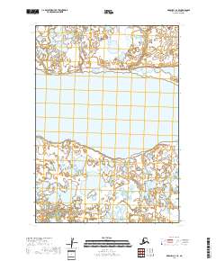
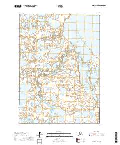
2018 Map of Marshall A-3 SE
USGS Topo · Published 2018About this map
Takslesluk Lake dominates this 2018 survey of the Bethel Census Area in Alaska, serving as the central geographic anchor for a landscape defined by an intricate network of wetlands and tundra. The map provides a detailed look at the Public Land Survey System divisions, specifically detailing sections within t12n r77w, t12n r76w, t11n r77w, and t11n r76w. This is a remote wilderness sheet where the hydrography is the primary feature of record. For researchers and historians, the map documents the precise state of this fluctuating shoreline and drainage basin as it appeared in the late 2010s, utilizing imagery from 2008 and updated hydrographic datasets to capture the shifting boundaries between water and land.
Find a feature on this map
5 named features on this map. Tap any name to fly to it.
Don’t see what you’re looking for? This feature index may not catch every label — zoom into the map to look around manually.
Map Details
Editions of this 2018 Marshall A-3 SE Map
This is the sole edition of this map. No revisions or reprints were ever made.
Other maps of this area

1951 · Marshall
USGS Topo · 1:250,000

1951 · Baird Inlet
USGS Topo · 1:250,000

1954 · Marshall A-2
USGS Topo · 1:63,360

1954 · Marshall A-3
USGS Topo · 1:63,360

1954 · Marshall
USGS Topo · 1:250,000

1954 · Baird Inlet
USGS Topo · 1:250,000
1954 · Baird Inlet D-3
USGS Topo · 1:63,360
1954 · Baird Inlet D-2
USGS Topo · 1:63,360
2017 · Baird Inlet D-3 NE
USGS Topo · 1:25,000
2017 · Baird Inlet D-2 NW
USGS Topo · 1:25,000