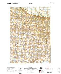
2018 Map of Marshall B-1 NE
USGS Topo · Published 2018About this map
The Reindeer River meanders across the northeast corner of this 2018 survey, defining a landscape dominated by the intricate wetlands and water bodies of the Yukon-Kuskokwim Delta. This map documents a remote stretch of the Alaskan interior where the boundary between the Kusilvak Census Area and the Bethel Census Area bisects a complex network of seasonal lakes and ponds. The absence of roads or established settlements reflects the subsistence-based character of the region, where travel is traditionally dictated by the flow of water and the seasonal changes of the tundra. Detailed hydrographic data from the U.S. Geological Survey provides an essential record of this shifting environment at the township level, specifically within the t16n r72w and t16n r71w grid sections.
Find a feature on this map
6 named features on this map. Tap any name to fly to it.
Don’t see what you’re looking for? This feature index may not catch every label — zoom into the map to look around manually.
Map Details
Editions of this 2018 Marshall B-1 NE Map
This is the sole edition of this map. No revisions or reprints were ever made.
Other maps of this area

1947 · Russian Mission
USGS Topo · 1:250,000

1950 · Russian Mission
USGS Topo · 1:250,000

1951 · Marshall
USGS Topo · 1:250,000

1952 · Russian Mission C-8
USGS Topo · 1:63,360

1952 · Russian Mission B-8
USGS Topo · 1:63,360

1952 · Marshall C-1
USGS Topo · 1:63,360
1954 · Marshall B-1
USGS Topo · 1:63,360

1954 · Marshall
USGS Topo · 1:250,000

1980 · Russian Mission
USGS Topo · 1:250,000
2017 · Russian Mission C-8 SW
USGS Topo · 1:25,000