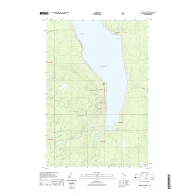
2019 Map of Marshall Creek
USGS Topo · Published 2019About this map
Lake Gogebic dominates this portion of the western Upper Peninsula, its southern reaches framed by the densely forested tracts of the Ottawa National Forest. The settlement of White City sits along the eastern shore, a focal point in a landscape otherwise defined by recreational trails and remote watercourses. The topography is etched with numerous creeks and seasonal drainages, including White Horse Creek and Marshall Creek, the latter featuring Marshall Falls near the southern tip of the lake.
Find a feature on this map
51 named features on this map. Tap any name to fly to it.
Don’t see what you’re looking for? This feature index may not catch every label — zoom into the map to look around manually.
Map Details
Editions of this 2019 Marshall Creek Map
This is the sole edition of this map. No revisions or reprints were ever made.
Other maps of this area

1952 · Thayer
USGS Topo · 1:62,500

1955 · Marenisco
USGS Topo · 1:62,500

1955 · Marenisco
USGS Topo · 1:24,000

1956 · Bergland
USGS Topo · 1:62,500

1956 · Matchwood
USGS Topo · 1:62,500

1958 · Iron River
USGS Topo · 1:250,000

1960 · Iron River
USGS Topo · 1:250,000

1961 · Iron River
USGS Topo · 1:250,000

1967 · Iron River
USGS Topo · 1:250,000

1979 · Ontonagon
USGS Topo · 1:100,000