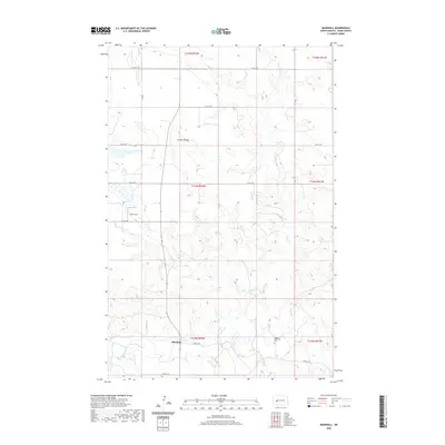
2020 Map of Marshall
USGS Topo · Published 2020About this map
Marshall sits along the southern edge of this Dunn County landscape, where the Knife River carves a winding path through the plains of western North Dakota. The area is defined by a series of drainages, including Coyote Cr and Fish Cr, which feed into the primary river valley. A notable point of genealogical interest is the Kyseth Memorial Cem located to the east of the settlement. The map reveals a grid of rural roads like Rodeo Rd and 20th ST SW that follow section lines, though the terrain remains mostly open. Named topographic features such as London Bridge and Smith Strip suggest local landmarks used by residents for navigation across the coulees, including Ash Coulee in the southeastern corner.
Find a feature on this map
21 named features on this map. Tap any name to fly to it.
Don’t see what you’re looking for? This feature index may not catch every label — zoom into the map to look around manually.
Map Details
Editions of this 2020 Marshall Map
This is the sole edition of this map. No revisions or reprints were ever made.
Other maps of this area

1953 · Watford City
USGS Topo · 1:250,000

1957 · Watford City
USGS Topo · 1:250,000

1967 · Watford City
USGS Topo · 1:250,000

1973 · Marshall SE
USGS Topo · 1:24,000

1973 · Willow Creek West
USGS Topo · 1:24,000

1973 · Schaffner Creek
USGS Topo · 1:24,000

1973 · Marshall SW
USGS Topo · 1:24,000

1973 · Halliday
USGS Topo · 1:24,000

1973 · Dodge
USGS Topo · 1:24,000

1973 · Werner
USGS Topo · 1:24,000