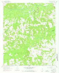
1962 Map of Marshall NW
USGS Topo · Published 1978About this map
The Vickie Lynn Oil Field and Woodlawn Oil Field dominate the northern and southern landscape of this Harrison County region, showcasing the deep-seated energy industry of East Texas during the mid-twentieth century. Scattered amongst the networks of pipelines and oil wells are numerous community landmarks that define the area's social history, including several country churches like St James Ch and New Zion Ch.
Find a feature on this map
31 named features on this map. Tap any name to fly to it.
Don’t see what you’re looking for? This feature index may not catch every label — zoom into the map to look around manually.
Map Details
Editions of this 1962 Marshall NW Map
2 editions found
Other maps of this area

1956 · Tyler
USGS Topo · 1:250,000

1961 · Hallsville
USGS Topo · 1:24,000

1961 · Lassater
USGS Topo · 1:24,000

1961 · Harleton
USGS Topo · 1:24,000

1962 · Kellyville
USGS Topo · 1:24,000

1962 · Marshall NW
USGS Topo · 1:24,000

1962 · Marshall West
USGS Topo · 1:24,000

1962 · Woodlawn
USGS Topo · 1:24,000

1962 · Jefferson
USGS Topo · 1:24,000

1962 · Marshall East
USGS Topo · 1:24,000