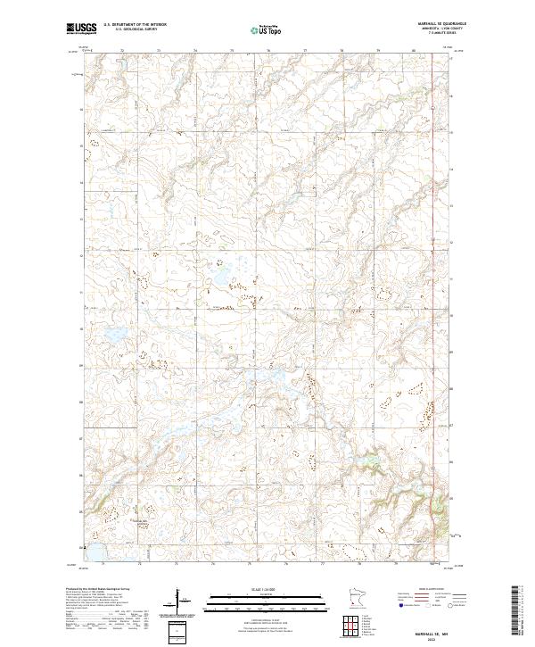
2022 Map of Marshall SE
USGS Topo · Published 2022About this map
The Coteau des Prairies upland dominates the southwest portion of this Lyon County landscape, where the elevation rises above the surrounding plains. The Cottonwood River meanders across the southern and central sections, its winding path creating a natural corridor through the structured grid of the Public Land Survey System. This intersection of natural topography and late-twentieth-century infrastructure is visible in the network of rural routes such as Co Rd 69 and Co Rd 20. The small drainage of Meadow Cr feeds into the larger river system, while the transition from residential streets like S Saratoga St to county highways indicates the proximity to larger developed areas. The map preserves the agricultural character of the region, showing the density of section lines and township boundaries that define modern land ownership in southwestern Minnesota.
Find a feature on this map
20 named features on this map. Tap any name to fly to it.
Don’t see what you’re looking for? This feature index may not catch every label — zoom into the map to look around manually.
Map Details
Editions of this 2022 Marshall SE Map
This is the sole edition of this map. No revisions or reprints were ever made.
Other maps of this area

1953 · New Ulm
USGS Topo · 1:250,000

1957 · New Ulm
USGS Topo · 1:250,000

1958 · New Ulm
USGS Topo · 1:250,000

1962 · Dudley
USGS Topo · 1:24,000

1962 · Amiret
USGS Topo · 1:24,000

1963 · Russell
USGS Topo · 1:24,000

1963 · Lynd
USGS Topo · 1:24,000

1963 · Marshall SE
USGS Topo · 1:24,000

1963 · Marshall
USGS Topo · 1:24,000

1967 · New Ulm
USGS Topo · 1:250,000