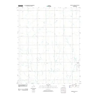
2010 Map of Marshall West
USGS Topo · Published 2010About this map
Marshall anchors the southeastern corner of this quadrangle, located at the edge of a grid-defined agricultural landscape. The township's layout is grounded by Virginia Ave, marking the transition from the concentrated settlement to the surrounding section-line roads. This area is defined by its drainage network, where several significant watercourses such as Skeleton Creek, Bitter Creek, and Wolf Creek meander across the plains.
Find a feature on this map
24 named features on this map. Tap any name to fly to it.
Don’t see what you’re looking for? This feature index may not catch every label — zoom into the map to look around manually.
Map Details
Editions of this 2010 Marshall West Map
This is the sole edition of this map. No revisions or reprints were ever made.
Other maps of this area

1893 · Lovell
USGS Topo · 1:62,500

1893 · Hennessey
USGS Topo · 1:62,500

1955 · Enid
USGS Topo · 1:250,000

1956 · Garber
USGS Topo · 1:62,500

1956 · Hennessey
USGS Topo · 1:62,500

1956 · Enid
USGS Topo · 1:62,500

1958 · Enid
USGS Topo · 1:250,000

1974 · Marshall West
USGS Topo · 1:24,000

1974 · Marshall East
USGS Topo · 1:24,000
1974 · Bridge Creek
USGS Topo · 1:24,000