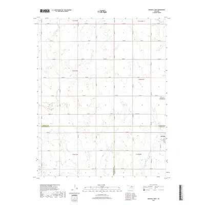
2018 Map of Marshall West
USGS Topo · Published 2018About this map
Skeleton Cr and its numerous tributaries, including Wolf Cr and Bitter Cr, define the drainage patterns of this rural landscape on the border of Garfield, Kingfisher, and Logan Counties. The area is characterized by a dense grid of section-line roads such as Osborne Rd and Sumner Rd that reflect the foundational land divisions of the region. The town of Marshall sits in the southeastern corner, serving as a focal point for the surrounding farming community. North of the town center lies the North Marshall Independent Order of Odd Fellows Cem, providing a specific point of interest for genealogists tracing families in the Marshall area. This 2018 survey captures the persistent agricultural character of the territory, where small watercourses like Horse Cr and Lyon Cr wind through the surveyed sections.
Find a feature on this map
54 named features on this map. Tap any name to fly to it.
Don’t see what you’re looking for? This feature index may not catch every label — zoom into the map to look around manually.
Map Details
Editions of this 2018 Marshall West Map
This is the sole edition of this map. No revisions or reprints were ever made.
Other maps of this area

1893 · Lovell
USGS Topo · 1:62,500

1893 · Hennessey
USGS Topo · 1:62,500

1955 · Enid
USGS Topo · 1:250,000

1956 · Garber
USGS Topo · 1:62,500

1956 · Hennessey
USGS Topo · 1:62,500

1956 · Enid
USGS Topo · 1:62,500

1958 · Enid
USGS Topo · 1:250,000

1974 · Marshall West
USGS Topo · 1:24,000

1974 · Marshall East
USGS Topo · 1:24,000
1974 · Bridge Creek
USGS Topo · 1:24,000