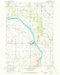
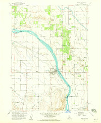
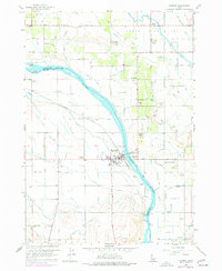
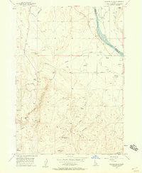
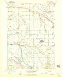
1958 Map of Marsing
USGS Topo · Published 1972About this map
Snake River separates the agricultural landscapes of Canyon and Owyhee counties, anchoring a complex network of irrigation and transport in this post-war Idaho survey. The town of Marsing sits at a strategic crossing, bolstered by nearby developments like Knowlton Heights and the small community of Riverside. The influence of the Union Pacific railroad is evident, carving through the terrain near Claytonia while supporting local industry indicated by various Gravel Pits and a Cinder Pit.
Find a feature on this map
52 named features on this map. Tap any name to fly to it.
Don’t see what you’re looking for? This feature index may not catch every label — zoom into the map to look around manually.
Map Details
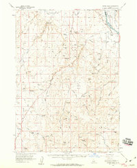
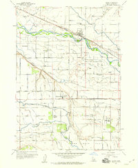
Editions of this 1958 Marsing Map
3 editions found
Other maps of this area

1892 · Silver City
USGS Topo · 1:125,000

1894 · Silver City
USGS Topo · 1:125,000

1898 · Nampa
USGS Topo · 1:125,000

1898 · Silver City
USGS Topo · 1:125,000

1955 · Boise
USGS Topo · 1:250,000
1957 · Opalene Gulch
USGS Topo · 1:24,000
1957 · Wilder
USGS Topo · 1:24,000
1957 · Sands Basin
USGS Topo · 1:62,500
1957 · Notus
USGS Topo · 1:24,000

1958 · Boise
USGS Topo · 1:250,000