1958 Map of Marsing
USGS Topo · Published 1977About this map
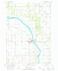
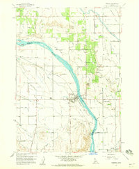
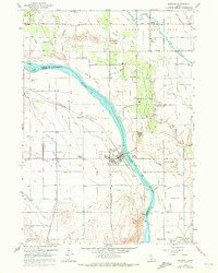
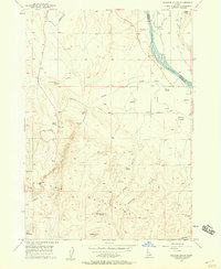
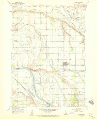
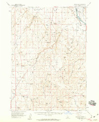
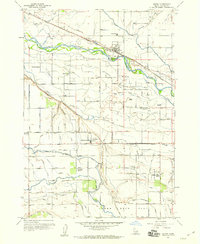
Marsing sits at a critical bend of the Snake River on this 1950s survey, updated with late-1970s land-use revisions. The landscape is defined by the complex irrigation networks of the Deer Flat High Line Canal and Mora Canal, which turned the arid benchlands into a productive agricultural corridor. Small rural hubs and education centers like Claytonia, Sunnyslope, and the Edson School anchor the farming community. The map reveals the local infrastructure of the era, from the Union Pacific Railroad line to local landmarks like Lizard Butte and Pickle Butte. Significant details for local history include the Symms Airport and several gravel and cinder pits that point to the region's mid-century development. Portions of the river are noted as part of the Snake River National Wildlife Refuge, excepting the privately owned Clarks Island.
Find a feature on this map
40 named features on this map. Tap any name to fly to it.
Don’t see what you’re looking for? This feature index may not catch every label — zoom into the map to look around manually.
Map Details
Editions of this 1958 Marsing Map
3 editions found
Other maps of this area

1892 · Silver City
USGS Topo · 1:125,000

1894 · Silver City
USGS Topo · 1:125,000

1898 · Nampa
USGS Topo · 1:125,000

1898 · Silver City
USGS Topo · 1:125,000

1955 · Boise
USGS Topo · 1:250,000
1957 · Opalene Gulch
USGS Topo · 1:24,000
1957 · Wilder
USGS Topo · 1:24,000
1957 · Sands Basin
USGS Topo · 1:62,500
1957 · Notus
USGS Topo · 1:24,000

1958 · Boise
USGS Topo · 1:250,000