
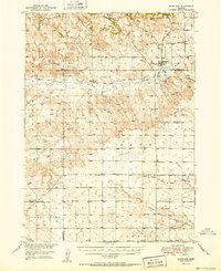
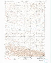
1951 Map of Marsland
USGS Topo · Published 1951This historical map portrays the area of Marsland in 1951, primarily covering Box Butte County as well as portions of Sioux County and Dawes County. Featuring a scale of 1:62500, this map provides a highly detailed snapshot of the terrain, roads, buildings, counties, and historical landmarks in the Marsland region at the time. Published in 1951, it is one of 3 known editions of this map due to revisions or reprints.
Find a feature on this map
25 named features on this map. Tap any name to fly to it.
Don’t see what you’re looking for? This feature index may not catch every label — zoom into the map to look around manually.
Map Details
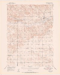
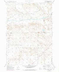
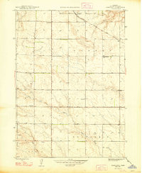
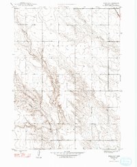
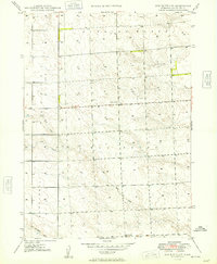
Editions of this 1951 Marsland Map
3 editions found
Historical Maps of Box Butte County Through Time
24 maps found

1946 Berea Creek East
Box Butte County, NE

1946 Nonpareil
Box Butte County, NE

1947 Alliance East
Box Butte County, NE

1947 Alliance West
Box Butte County, NE

1947 Box Butte
Box Butte County, NE
1947 Box Butte NE
Box Butte County, NE
1948 Barrel Springs Creek North
Box Butte County, NE
1948 Barrel Springs Creek South
Box Butte County, NE

1948 Berea Creek East
Box Butte County, NE

1948 Berea Creek West
Box Butte County, NE

1948 Hagaman Cemetery
Box Butte County, NE
1948 Nonpareil
Box Butte County, NE
1948 School No. 7
Box Butte County, NE

1949 Box Butte
Box Butte County, NE

1949 Box Butte NE
Box Butte County, NE
1949 Box Butte SW
Box Butte County, NE

1949 Bronco Lake
Box Butte County, NE

1951 Kilpatrick Lake
Box Butte County, NE
1951 Marsland
Box Butte County, NE

1983 Kilpatrick Lake
Box Butte County, NE

1983 Kilpatrick Lake NE
Box Butte County, NE

1983 Kilpatrick Lake NW
Box Butte County, NE

1983 Marsland SE
Box Butte County, NE

1983 Marsland SW
Box Butte County, NE