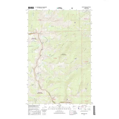
2017 Map of Martin Peak
USGS Topo · Published 2017About this map
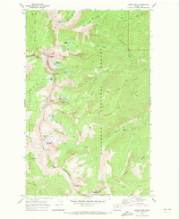
Sawtooth Ridge and Martin Peak anchor this high-elevation landscape along the boundary of Okanogan and Chelan counties. This terrain is defined by a series of alpine basins and glacially-carved features, including Merchants Basin and Horsethief Basin. The area serves as a significant drainage divide, with waters flowing through Libby Creek and Martin Creek, punctuated by remote high-altitude bodies of water such as Upper Eagle Lake, Boiling Lake, and Cooney Lake. A network of backcountry access routes, including the Summit Trail ORV and Angel Staircase, traverses the steep ridges between Mt Bigelow and N Navarre Peak. The map illustrates the shared stewardship of this wilderness by the Wenatchee National Forest and Okanogan National Forest, showing the detailed topography surrounding landmarks like Bryan Butte and the dramatic Foggy Dew Falls.
Find a feature on this map
65 named features on this map. Tap any name to fly to it.
Don’t see what you’re looking for? This feature index may not catch every label — zoom into the map to look around manually.
Map Details
Editions of this 2017 Martin Peak Map
This is the sole edition of this map. No revisions or reprints were ever made.
Other maps of this area

1899 · Methow
USGS Topo · 1:125,000

1901 · Methow
USGS Topo · 1:125,000

1955 · Concrete
USGS Topo · 1:250,000

1958 · Concrete
USGS Topo · 1:250,000

1962 · Concrete
USGS Topo · 1:250,000

1968 · South Navarre Peak
USGS Topo · 1:24,000
1968 · Big Goat Mtn
USGS Topo · 1:24,000
1968 · Oss Peak
USGS Topo · 1:24,000
1968 · Hungry Mtn
USGS Topo · 1:24,000
1969 · Martin Peak
USGS Topo · 1:24,000