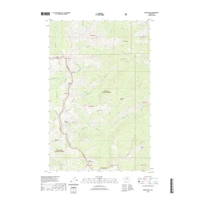
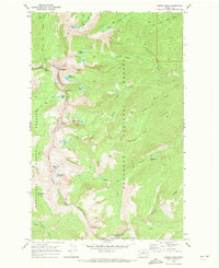
2020 Map of Martin Peak
USGS Topo · Published 2020About this map
Martin Peak and North Navarre Peak dominate the high-elevation divide where the Okanogan National Forest meets the Wenatchee National Forest. This high-country landscape is defined by the massive alpine crest of Sawtooth Ridge, a geographic spine that separates the drainage of the Middle Fork Prince Cr from the various branches of Libby Creek and Crater Creek. The area is characterized by high glacial basins and secluded water bodies, including Upper Eagle Lake and Cooney Lake, which sit at the headwaters of steeply descending mountain streams. Notable transit routes through this wilderness include the Hoodoo Pass and Horsehead Pass, providing passage through the formidable ridges. The presence of specialized recreational designations like the Prince Creek ORV and Summit Trail ORV indicates the modern management of these forests for high-altitude exploration and trail connectivity.
Find a feature on this map
61 named features on this map. Tap any name to fly to it.
Don’t see what you’re looking for? This feature index may not catch every label — zoom into the map to look around manually.
Map Details
Editions of this 2020 Martin Peak Map
This is the sole edition of this map. No revisions or reprints were ever made.
Other maps of this area

1899 · Methow
USGS Topo · 1:125,000

1901 · Methow
USGS Topo · 1:125,000

1955 · Concrete
USGS Topo · 1:250,000

1958 · Concrete
USGS Topo · 1:250,000

1962 · Concrete
USGS Topo · 1:250,000

1968 · South Navarre Peak
USGS Topo · 1:24,000
1968 · Big Goat Mtn
USGS Topo · 1:24,000
1968 · Oss Peak
USGS Topo · 1:24,000
1968 · Hungry Mtn
USGS Topo · 1:24,000
1969 · Martin Peak
USGS Topo · 1:24,000