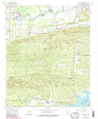
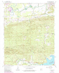
1963 Map of Martindale
USGS Topo · Published 1984About this map
Wye Mountain anchors this 1963 survey of the Arkansas river valleys, capturing a landscape where upland ridges descend into the complex hydrology of the La Fave River and Fourche River. Near the northern boundary, the Harris Brake State Wildlife Management Area and the oxbows of Winford Brake indicate a lowland prone to seasonal flooding, while the southern margin is defined by the expansive waters of Lake Maumelle.
Find a feature on this map
38 named features on this map. Tap any name to fly to it.
Don’t see what you’re looking for? This feature index may not catch every label — zoom into the map to look around manually.
Map Details
Editions of this 1963 Martindale Map
5 editions found
Other maps of this area

1889 · Morrilton No. 3
USGS Topo · 1:62,500

1890 · Benton
USGS Topo · 1:125,000

1892 · Morrillton
USGS Topo · 1:125,000

1894 · Morrillton
USGS Topo · 1:125,000

1894 · Benton
USGS Topo · 1:125,000

1955 · Little Rock
USGS Topo · 1:250,000

1956 · Little Rock
USGS Topo · 1:250,000

1956 · Russellville
USGS Topo · 1:250,000

1960 · Little Rock
USGS Topo · 1:250,000

1961 · Perryville
USGS Topo · 1:24,000