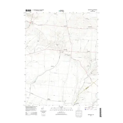
2013 Map of Martinsville
USGS Topo · Published 2013About this map
Martinsville and Lynchburg anchor this topographical study of the borderlands between Clinton and Highland Counties. The landscape is defined by the drainage of the E Fork Little Miami River and the W Fork E Fork Little Miami River, where small family-named sites and farming communities are clustered. Local history is deeply embedded in the many burial grounds recorded here, including the Masonic Cem near the southern edge and the Turner Family Cem just east of the village center. This 2013 survey illustrates the persistence of early agricultural and settlement patterns, with several clusters such as Jonesboro and Farmers still identified by name. Distinctive infrastructure like the Martinsville Road Bridge and Barnett Airpark show the evolution of transit through this rural corridor, which remains relatively undisturbed by large-scale urban development.
Find a feature on this map
59 named features on this map. Tap any name to fly to it.
Don’t see what you’re looking for? This feature index may not catch every label — zoom into the map to look around manually.
Map Details
Editions of this 2013 Martinsville Map
This is the sole edition of this map. No revisions or reprints were ever made.
Other maps of this area

1907 · Blanchester
USGS Topo · 1:62,500

1917 · Hillsboro
USGS Topo · 1:62,500

1917 · Sabina
USGS Topo · 1:62,500

1917 · Sardinia
USGS Topo · 1:62,500

1943 · Sabina
USGS Topo · 1:62,500

1944 · Hillsboro
USGS Topo · 1:62,500

1944 · Sardinia
USGS Topo · 1:62,500

1947 · Columbus
USGS Topo · 1:250,000
1960 · Lynchburg
USGS Topo · 1:24,000

1960 · Martinsville
USGS Topo · 1:24,000