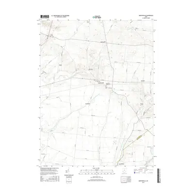
2016 Map of Martinsville
USGS Topo · Published 2016About this map
Martinsville sits at the heart of this southwestern Ohio landscape, serving as a central hub for the surrounding agricultural community. The terrain is defined by the branching waterways of the Little Miami River system, including the W Fork E Fork Little Miami River and the E Fork Little Miami River. These streams create a rolling topography that has shaped the placement of local roads like Co RD 14 and Townsend RD, which follow the natural contours of the land.
Find a feature on this map
71 named features on this map. Tap any name to fly to it.
Don’t see what you’re looking for? This feature index may not catch every label — zoom into the map to look around manually.
Map Details
Editions of this 2016 Martinsville Map
This is the sole edition of this map. No revisions or reprints were ever made.
Other maps of this area

1907 · Blanchester
USGS Topo · 1:62,500

1917 · Hillsboro
USGS Topo · 1:62,500

1917 · Sabina
USGS Topo · 1:62,500

1917 · Sardinia
USGS Topo · 1:62,500

1943 · Sabina
USGS Topo · 1:62,500

1944 · Hillsboro
USGS Topo · 1:62,500

1944 · Sardinia
USGS Topo · 1:62,500

1947 · Columbus
USGS Topo · 1:250,000
1960 · Lynchburg
USGS Topo · 1:24,000

1960 · Martinsville
USGS Topo · 1:24,000