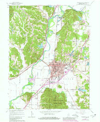
1965 Map of Martinsville
USGS Topo · Published 1980About this map
Martinsville serves as the focal point of this mid-century survey, situated along the White River in a landscape defined by significant topographic relief and water management. The area's commitment to conservation and recreation is evident in the sprawling Morgan Monroe State Forest to the south and numerous smaller bodies of water like Lake Edgewood and Patton Lake. The map details a sophisticated network of local roads such as Cramertown Loop and Grassy Fork Road that connect outlying residential developments like Shelburne and Woodcrest with the town's industrial and civic core, including the Courthouse, Armory, and Fish Hatchery.
Find a feature on this map
98 named features on this map. Tap any name to fly to it.
Don’t see what you’re looking for? This feature index may not catch every label — zoom into the map to look around manually.
Map Details
Editions of this 1965 Martinsville Map
4 editions found
Other maps of this area

1942 · Franklin
USGS Topo · 1:125,000

1948 · Hindustan
USGS Topo · 1:24,000

1948 · Morgantown
USGS Topo · 1:24,000

1950 · Morgantown
USGS Topo · 1:24,000

1953 · Indianapolis
USGS Topo · 1:250,000

1955 · Hall
USGS Topo · 1:24,000

1955 · Cope
USGS Topo · 1:24,000

1955 · Mooresville West
USGS Topo · 1:24,000

1955 · Martinsville
USGS Topo · 1:24,000

1955 · Mooresville East
USGS Topo · 1:24,000