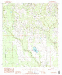
1983 Map of Martinville
USGS Topo · Published 1988About this map
The Tchefuncta River and its numerous tributaries, including Morgan Branch and Bogue Falaya, carve through this section of St. Tammany Parish, defining a landscape of wetlands and winding waterways. The settlement of Martinville serves as a central point in an area characterized by dispersed rural homesteads and an unusually high density of family and community burial grounds. Researchers will find numerous genealogical landmarks, such as St Johns Cem, Willie Cem, and Burns Cem, often situated near local congregations like Savannah Branch Ch or Live Oak Ch.
Find a feature on this map
44 named features on this map. Tap any name to fly to it.
Don’t see what you’re looking for? This feature index may not catch every label — zoom into the map to look around manually.
Map Details
Editions of this 1983 Martinville Map
3 editions found
Other maps of this area

1935 · Covington
USGS Topo · 1:62,500

1935 · Ponchatoula
USGS Topo · 1:62,500

1939 · Ponchatoula
USGS Topo · 1:62,500

1939 · Zona
USGS Topo · 1:31,680

1939 · Covington
USGS Topo · 1:62,500

1942 · Onville
USGS Topo · 1:31,680

1942 · Waldheim
USGS Topo · 1:31,680

1942 · Husser
USGS Topo · 1:31,680

1942 · Robert
USGS Topo · 1:31,680

1950 · Folsom
USGS Topo · 1:31,680