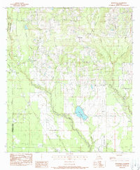
1983 Map of Martinville
USGS Topo · Published 1988About this map
The Tchefuncta River and Bogue Falaya wind through this part of St. Tammany Parish, defining a landscape of dense creek networks and scattered rural settlements during the early 1980s. The small community of Martinville sits central to the map, surrounded by numerous family and community landmarks such as Fendlason Cem and Willie Cem, which provide significant genealogical touchpoints for the area. The presence of St Johns Ch and Savannah Branch Ch indicates the importance of local parishes in this timbered terrain.
Find a feature on this map
40 named features on this map. Tap any name to fly to it.
Don’t see what you’re looking for? This feature index may not catch every label — zoom into the map to look around manually.
Map Details
Editions of this 1983 Martinville Map
3 editions found
Other maps of this area

1935 · Covington
USGS Topo · 1:62,500

1935 · Ponchatoula
USGS Topo · 1:62,500

1939 · Ponchatoula
USGS Topo · 1:62,500

1939 · Zona
USGS Topo · 1:31,680

1939 · Covington
USGS Topo · 1:62,500

1942 · Onville
USGS Topo · 1:31,680

1942 · Waldheim
USGS Topo · 1:31,680

1942 · Husser
USGS Topo · 1:31,680

1942 · Robert
USGS Topo · 1:31,680

1950 · Folsom
USGS Topo · 1:31,680