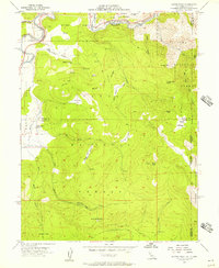
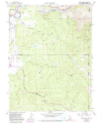
1955 Map of Martis Peak
USGS Topo · Published 1957About this map
Martis Peak stands as the high point of this Sierra Nevada landscape, looking down over the Truckee River and the winding tracks of the Southern Pacific railroad. The mid-1950s environment is one of managed wilderness and remnant pioneer industry, where the Union Mills (Site) near Hirschdale marks a legacy of timber production. The map captures a transition between the Tahoe Nat Forest and the Toiyabe National Forest, showing a network of logging and service access through numerous Jeep Trails. Local history is preserved in the naming of the Old Joerger Ranch and the isolated Brockway Guard Sta, while the hydrology of the area is detailed through features like Klondike Meadow and the headwaters of Martis Creek. The survey provides a clear view of the complex terrain at Brockway Summit and the high-elevation flats like Sawmill Flat, reflecting an era of seasonal grazing and forest management before modern development intensified around the Tahoe basin.
Find a feature on this map
42 named features on this map. Tap any name to fly to it.
Don’t see what you’re looking for? This feature index may not catch every label — zoom into the map to look around manually.
Map Details
Editions of this 1955 Martis Peak Map
5 editions found
Other maps of this area

1891 · Carson
USGS Topo · 1:125,000

1891 · Truckee
USGS Topo · 1:125,000

1893 · Carson
USGS Topo · 1:125,000

1893 · Truckee
USGS Topo · 1:125,000

1895 · Truckee
USGS Topo · 1:125,000

1932 · Truckee
USGS Topo · 1:96,000

1940 · Truckee
USGS Topo · 1:125,000

1950 · Mt. Rose
USGS Topo · 1:62,500

1952 · Mt. Rose
USGS Topo · 1:62,500

1955 · Truckee
USGS Topo · 1:24,000