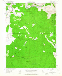
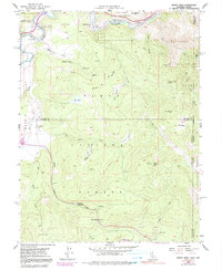
1955 Map of Martis Peak
USGS Topo · Published 1963About this map
Southern Pacific rail lines track the northern bend of the Truckee River on this 1950s survey of the high Sierra borderlands. The landscape is defined by its transition from industrial riverfront to the managed timberlands of the Tahoe Nat Forest. While the settlement of Hirschdale marks the river corridor, much of the interior is characterized by remote outposts and former commercial hubs, including the Union Mills (Site) and the Old Joerger Ranch.
Find a feature on this map
43 named features on this map. Tap any name to fly to it.
Don’t see what you’re looking for? This feature index may not catch every label — zoom into the map to look around manually.
Map Details
Editions of this 1955 Martis Peak Map
5 editions found
Other maps of this area

1891 · Carson
USGS Topo · 1:125,000

1891 · Truckee
USGS Topo · 1:125,000

1893 · Carson
USGS Topo · 1:125,000

1893 · Truckee
USGS Topo · 1:125,000

1895 · Truckee
USGS Topo · 1:125,000

1932 · Truckee
USGS Topo · 1:96,000

1940 · Truckee
USGS Topo · 1:125,000

1950 · Mt. Rose
USGS Topo · 1:62,500

1952 · Mt. Rose
USGS Topo · 1:62,500

1955 · Truckee
USGS Topo · 1:24,000