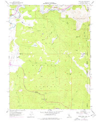
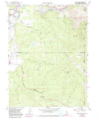
1955 Map of Martis Peak
USGS Topo · Published 1977About this map
The Southern Pacific railroad corridor and the Truckee River dominate the northern landscape of this 1955 survey, where the small settlement of Hirschdale sits near the river's bend. The map documents a rugged timber and grazing region on the California-Nevada border, highlighted by the industrial history at the Union Mills (Site) in Union Valley. In the high country to the south, Martis Peak rises above a network of drainages including East Martis Creek and Monte Carlo Meadows Creek.
Find a feature on this map
48 named features on this map. Tap any name to fly to it.
Don’t see what you’re looking for? This feature index may not catch every label — zoom into the map to look around manually.
Map Details
Editions of this 1955 Martis Peak Map
5 editions found
Other maps of this area

1891 · Carson
USGS Topo · 1:125,000

1891 · Truckee
USGS Topo · 1:125,000

1893 · Carson
USGS Topo · 1:125,000

1893 · Truckee
USGS Topo · 1:125,000

1895 · Truckee
USGS Topo · 1:125,000

1932 · Truckee
USGS Topo · 1:96,000

1940 · Truckee
USGS Topo · 1:125,000

1950 · Mt. Rose
USGS Topo · 1:62,500

1952 · Mt. Rose
USGS Topo · 1:62,500

1955 · Truckee
USGS Topo · 1:24,000