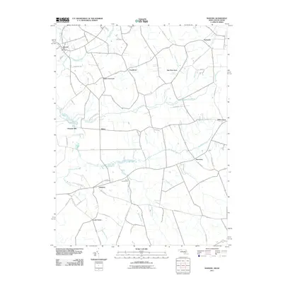
2011 Map of Marydel
USGS Topo · Published 2011About this map
Marydel straddles the state line in this detail-rich landscape defined by a sophisticated network of agricultural drainage. The area's history is written in its waterways, where the Choptank River begins its journey alongside artificial channels like Tappahanna Ditch and Culbreth Marsh Ditch. These ditches, essential for reclaiming the fertile lowlands, surround historic rural junctions such as Smith Crossroads and Chapeltown. Small agrarian settlements and family-named locations remain the backbone of the region's geography, with the Marydel Post Office serving as a central landmark for the cross-border community.
Find a feature on this map
63 named features on this map. Tap any name to fly to it.
Don’t see what you’re looking for? This feature index may not catch every label — zoom into the map to look around manually.
Map Details
Editions of this 2011 Marydel Map
This is the sole edition of this map. No revisions or reprints were ever made.
Other maps of this area

1899 · Dover
USGS Topo · 1:125,000

1905 · Denton
USGS Topo · 1:62,500

1905 · Barclay
USGS Topo · 1:62,500

1906 · Dover
USGS Topo · 1:125,000

1918 · Harrington
USGS Topo · 1:62,500

1920 · Dover
USGS Topo · 1:125,000

1926 · Wyoming
USGS Topo · 1:48,000

1930 · Wyoming
USGS Topo · 1:62,500

1931 · Wyoming
USGS Topo · 1:62,500

1944 · Denton
USGS Topo · 1:31,680