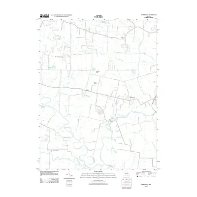
2012 Map of Maryknoll
USGS Topo · Published 2012About this map
The Cuivre River winds through the southern reaches of this landscape, anchoring a network of creeks and branches including Bobs Creek and the Jordan Branch. This 2012 survey illustrates the rural residential patterns of eastern Lincoln County, where established settlements like Ethlyn and Maryknoll are complemented by the riverside community of Chain of Rocks. The presence of the Chantilla Post Office and several family-named landmarks like the Rybolt Cemetery and Admire Cemetery provide valuable geographic touchstones for genealogists tracing local families. To the north, the small Blackhawk Airport and the waters of Schlueter Heddinger Lake add distinct navigational and recreational markers to the terrain. The area is characterized by a dense web of local roads, such as Birkhead Trl and Elston Rd, connecting these small unincorporated communities and family farms.
Find a feature on this map
115 named features on this map. Tap any name to fly to it.
Don’t see what you’re looking for? This feature index may not catch every label — zoom into the map to look around manually.
Map Details
Editions of this 2012 Maryknoll Map
This is the sole edition of this map. No revisions or reprints were ever made.
Other maps of this area

1903 · O'Fallon
USGS Topo · 1:125,000

1930 · Hardin
USGS Topo · 1:62,500

1931 · Brussels
USGS Topo · 1:62,500

1934 · Elsberry
USGS Topo · 1:48,000

1934 · Hardin
USGS Topo · 1:62,500

1938 · Hardin
USGS Topo · 1:62,500

1939 · Brussels
USGS Topo · 1:62,500

1941 · Troy
USGS Topo · 1:62,500

1942 · Elsberry
USGS Topo · 1:62,500

1943 · Brussels
USGS Topo · 1:62,500